Show the map
Certified Track - ITRA
Trail de Nantes à Montaigu 2022 - Trail de la Digue
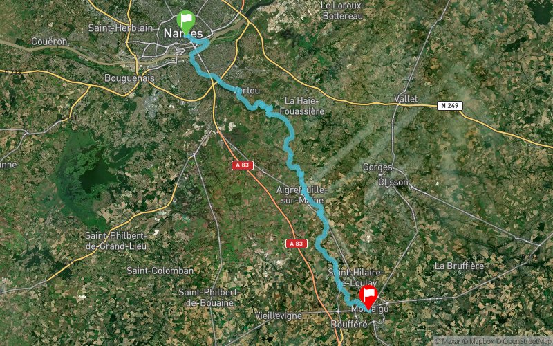


53 km
450 m
420 m
 Nantes (FR)
 Montaigu-Vendee (FR)
 1
1 Points of Interest table
| Accum. | Intermediary | |||||||
|---|---|---|---|---|---|---|---|---|
| POI | Description | Alt. | Dist. | D+ | D- | Dist. | D+ | D- |
 Competition organized on 09/24/2022
Trace n°176001
Ascent threshold : 3 m Distance threshold : 30 m Smoothing : Yes Origin of altitudes : MNT IGN
Ascent threshold : 3 m Distance threshold : 30 m Smoothing : Yes Origin of altitudes : MNT IGN
Crossing
Dominant terrain : Footpath
Max alti. : 56 m
Avg alti. : 18 m
Min alti. : -1 m
Longest ascent : 60 m
Longest descent : 60 m
Dominant terrain : Footpath
Max alti. : 56 m
Avg alti. : 18 m
Min alti. : -1 m
Longest ascent : 60 m
Longest descent : 60 m
More tools
Create a new roadbook page
Map and track on your website
Warning ! When you insert a Trace de Trail map on your website, you agree not to hide any element of the module (links to Trail Trail or Trail Connect banner)
Add a realisation
Validate
Add a realisation to share your chrono and describe the conditions that you encountered during you trail running !
Add a comment
Validate
Show the infos
Add a track